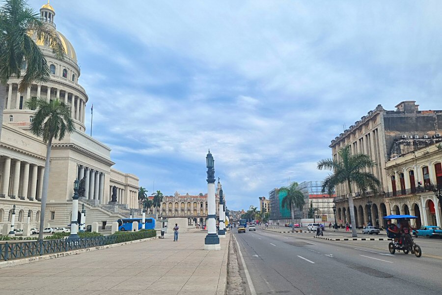
The Paseo de Martí is an avenue that
extends sloping down from the Fuente de la India and the Parque
de Fraternidad to the Malecón (Avenue del Puerto).
Paseo de Martí
The Paseo de Martí separates the Old Havana
from the Centro Habana.
The Old Havana was surrounded by
city walls for the safety reasons during the second half of
the 18th century, but by passage of time the city grew,
particularly in the direction of north, and the intramural
public spaces were not sufficient anymore for the recreation
and social life of the habeneros, so that it became
necessary to overcome the limits imposed by the walls.
When the Captain General and
Governor Marquis de la Torre (Don Felipe Fonsdeviela y
Ondeano) took office in Cuba in 1771, he started a new
urbanization program that included the construction of two
avenues (the Alameda de Paula and the current Paseo de Martí),
the first theater of Havana (El Principal) and a
governmental palace (Palacio de los Capitanes Generales)
that would commensurate with the rank of the capitol of
Havana. According to the project, the first goal was to
build a great extramural promenade like in Paris that would
be one kilometer long, extending between two doors of the
city walls.
Thus, the construction of the
current Paseo de Martí, the first avenue located outside the
old city walls, began in 1772, but the Captain General
Miguel Tacón y Rosique (1834-1838), the first great urban
planner of the city, converted the mall into an avenue with
two rows of trees at its beginnings, and extended it to the
coast (to that what is Malecón today). Soon it became the
promenade of the Havana society of the time that was eager
to have a place for leisure and walking, particularly at
dusk. It received the name Nuevo Prado, but the name Alameda
de Extramuros, for being outside of the city walls, was
adopted in the majority. The Governor Tacón, inspired by the
Las Ramblas in Barcelona, changed the rural character of the
Alameda de Extramuros by widening the road and favoring the
construction of a series of public buildings nearby, such as
the Teatro Tacón and the Real Cárcel.
It was a broad avenue, connecting
the Campo de Martes to the sea. Even though there were
barracks for soldiers in the vicinity of the promenade that
were converted later into barracks for African slaves, it
became the center of the social life of Havana of the time.
With the inauguration of the Teatro Tacón in 1838, nowadays
Gran Teatro de la Habana Alicia Alonso, and some cafés, such
as the Café Escauriza (opened in 1843) with El Louvre ice
cream shop in its upper floors, the Alameda de Extramuros
increased in importance among the Havana society. The
construction of the Paseo Militar (Military Walk) that later
became known as Carlos III in 1834, as well as the
construction of the Fuente de la India in 1837 that was
erected at the end of the Alameda de Extramuros in a place,
where the statue of the King Carlos III had been since 1803,
had also a role in the flourishing of the avenue that day by
day became the fundamental artery of the city.
In 1840, the avenue was baptized by
the Captain General Pedro Téllez Girón (1840-1841) with the
name of the Spanish Queen Isabel II, and thereafter the
avenue was called as the Alameda de Isabel II.
Although in the first half of the 19th century the avenue was used exclusively for pedestrians, in the second half of the same century the habaneros preferred the ride on horse-drawn carriages to the pedestrian walk to enjoy the excellence of the landscape, as the daily carriage ride along the boulevard was an important social ritual with bands positioned at regular intervals to play to the parade of the carriages.
In 1884, the Alameda de Isabel II was
remodeled by adding street lighting, benches and pavements.
Gradually the former baroque and colonial style buildings
were replaced by the large and lavish neoclassical buildings
on either side throughout the avenue that made the area more
appealing.
The structure of the Prado remained
unchanged through the years. During the American
intervention, the name of the Avenida de Isabel II changed
to Paseo de Martí to the memory of José Martí in 1904, the
hero of the fight for independent Cuba. Even though, the
avenue is called as the Paseo de Martí officially, it
remained as Paseo de Prado, or just El Prado, for many,
maybe because of it great resemblance to its counterpart in
Madrid between the Fuente de Cibeles and the metro station
Atocha or because it was simpler to call so.
During the last decades of the 19th
century and the first of the 20th, the wealthy families
built their mansions on either side of the Paseo del Prado
that made the area more appealing. The new district on the
west of the capital became invaded by luxury shops, mainly
dedicated to tourism, followed by offices, hotels, and
cafes.
In the period of Alfredo Zayas
(1921-1925), the fourth president of the republic, pine
trees were planted. In the time of the President Gerardo
Machado (1925-1933) a city master plan was put into practice, in
that the promenade got its share. The French landscape
architect Jean-Claude Nicolas Forestier that undertook the
building of the Parque de la Fraternidad, remodeled also the
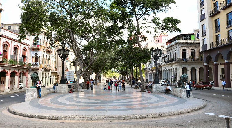
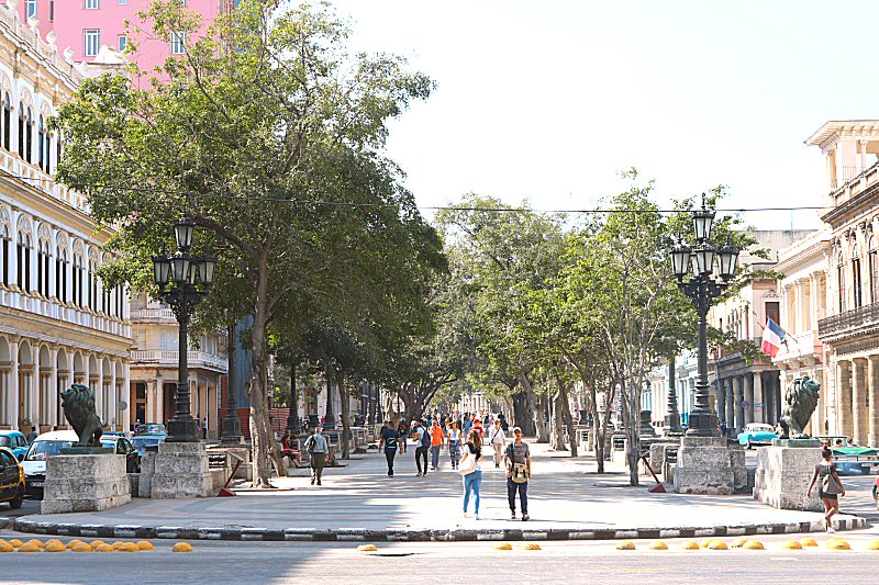
promenade in 1929. Marble benches and artistic street lamps
that provided excellent lighting, were added to the place.
The central promenade was paved with a beautiful terrazzo
floor. Many laurels were planted, and the famous lion
statues were placed. Thus, the promenade took its current
form.
IIn the 20th century the Paseo de Martí lost its residential character, but this changed after it was included in the limits of the Old Center that was declared a World Heritage Site by UNESCO in 1982.


